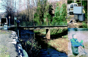
The Riou Mort River watershed (SW France), representative of a heavily polluted, small, heterogeneous watershed, represents a major source for the polymetallic pollution of the Lot–Garonne–Gironde fluvial–estuarine system due to former mining and ore-treatment activities. In order to assess spatial distribution of the metal/metalloid contamination in the watershed, a high resolution hydrological and geochemical monitoring were performed during one year at four permanent observation stations. Additionally, thirty-five stream sediment samples were collected at representative key sites and analyzed for metal/metalloid (Cd, Zn, Cu, Pb, As, Sb, Mo, V, Cr, Co, Ni, Th, U and Hg) concentrations. The particulate concentrations in water and stream sediments show high spatial differences for most of the studied elements suggesting strong anthropogenic and/or lithogenic influences; for stream sediments, the sequence of the highest variability, ranging from 100% to 300%, is the following: Mo < Cu < Hg < As < Sb < Cd < Zn < Pb. Multidimensional statistical analyses combined with metal/metalloid maps generated by GIS tool were used to establish relationships between elements, to identify metal/metalloid sources and localize geochemical anomalies attributed to local geochemical background, urban and industrial activities. Finally, this study presents an approach to assess anthropogenic trace metal inputs within this watershed by combining lithology-dependent geochemical background values, metal/metalloid concentrations in stream sediments and mass balances of element fluxes at four key sites. The strongest anthropogenic contributions to particulate element fluxes are 90–95% for Cd, Zn and Hg in downstream sub-catchments. The localisation of anthropogenic metal/metalloid sources in restricted areas offers a great opportunity to further significantly reduce metal emissions and restore the Lot–Garonne–Gironde fluvial–estuarine ecosystem.


 Please wait while we load your content...